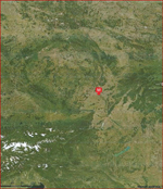
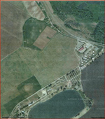
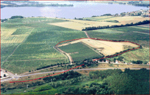
The key site for our understanding of Roman military activities north of the Middle Danube, the location „Burgstall-Hradisko” in Mušov, is situated in the south-eastern part of the Czech Republic. It lies on a low hill overlooking the open landscape in the wider surroundings of the confluences of three rivers, the Svitava, the Jihlavka and the Dyje, about 50 miles north of the Roman frontier on the Danube.
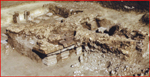
Archaeological excavations carried out at this location by A. Gnirs in the late 1920s have revealed two Roman-style masonry buildings, a small bath and the so-called house of commander (praetorium ?) equipped with hypocaustum. According to A. Gnirs they were surrounded by a quadrangular enclosure of the 60 x 63 m approximate size and interpreted as a small Roman military „station”
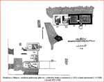
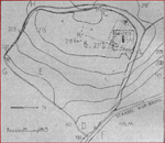
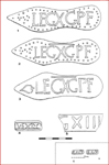
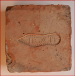
Despite the discovery of typical Roman pottery, numerous Roman bricks bearing the stamp LEG X GPF and a few antique small finds there has been much discussion about the actual role of the site.
Various scholars expressed their doubts to the thesis speculating
about a Roman military installation, and they pointed out issues such as the
absence of an effective fortification and the specific layout of internal structures
resembling a provincial villa rustica. New interpretations have emerged regarding
the site as being a trade station but no definitive answer has been reached.
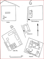
Only over the last decades some quite new views on the nature of the Roman site in Mušov and its entire military, political and cultural impact on the barbarian territory north of the Middle Danube have been developed by archaeological research. The field work has revealed that the site was neither simply a station of more or less villa-character nor a trading post or a residency of a Germanic prince but a Roman arrangement of a considerable importance at the time of the Marcomannic wars.
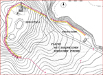
As has been recorded there is no evidence of an earlier Germanic
occupation of the site, and the explanation designating Mušov-Burgstall as
the Germanic
„hillfort” has to be doubted. Even the theory that in was only a villa with
stone buildings surrounded by an approximately quadrangular enclosure has not
been
corroborated. Furthermore it has been proved that the walls of the 21 m long
and abt. 6 m wide rectangular building were constructed with woven wattle panels
plastered and whitewashed externally and also painted internally
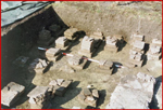
as demonstrated by finds of plaster fragments. The substructures as hypocaust
and heated parts of the bath etc. were built from stone or from Roman bricks.
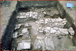
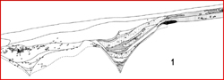
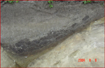
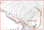
The assumption that there was an absence of installations for defence purposes was revised by a discovery of huge defensive earthworks surrounding the hill and its adjacent parts. The field work carried out there has added new findings concerning its construction and size. The massive defences encircling the area on the western and northern sides consist of a ditch, about 2.40 to 2.50 meters deep and 5 meters wide. Stretches of the original core of the clay rampart with the timber-revetted inner face have in some places survived as an upright earthwork. Traces of a timber construction were found as a row of postholes following the rear. The sections through the wall on the north-eastern foothill of the rise have revealed a continuation of the main defence line consisting of a clay rampart and a ditch, which ran down the slope towards the modern Brno-Mikulov road and the flat terrace of the Jihlava River to the location Mušov-Neurissen.
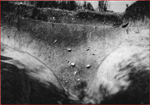
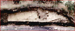
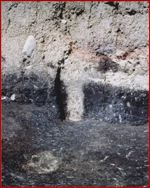
There it obviously continues into the fortification discovered here in 1993. In the south-west corner of the Burgstall, the earth-timber rampart appears to turn abruptly in the south-eastern direction. At this location a series of trenches have provided an evidence of a double ditch by which the fort has been surrounded from west and south. The remains of clay bricks, many of them desintegrated, which have slided down the slope of the wall destruction and the internal side of the ditch indicated that the rampart was revetted internally and externally with clay bricks.
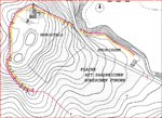
The whole fortification originally
enclosed
an extensive area of about 40 to50 hectares; it differs from typical Roman
camps or forts set up in the provinces in its shape copying the local topography.
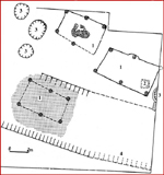
Further excavations on the south-eastern slope of „Burgstall” have provided
evidence of metalworking within the fortified area. About 6 m long and 4 m
wide barracks
of a rectangular ground plan with a post construction and a daub plaster have
revealed a large number of fragmentary pieces of melted alloy, and remains
of a board containing a lot of scrap metal have yielded an evidence for the
repairing
and probable manufacture of Roman weapons and equipment.
The character
of Roman artifacts and coins indicates that this metalworking has been carried
out here during the Roman occupation of the hill, i.e. between 172 and 180
A.D. Some other structures for the purposes of supply or storage, like an oven
for
bread baking dated by coins of Marcus Aurelius, have been uncovered providing
the evidence that military associated civilians must have been engaged here.
In recent years discussion arose concerning the structures in the Neurissen
location situated on the flat terrace at the foot of the hillfort of „Burgstall”.
Aerial
photos of this location show crop-marked traces of Roman installations.
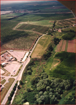
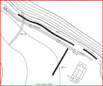
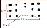
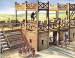
The rescue dig has revealed several earth works corroborating that the area had been used by the Roman army. The remnants of a ditch and a turf and clay rampart (vallum) running along the northern edge of the oblong shaped terrace and a 16 m wide timber gate with two towers supported by a six-post structure were the most interesting features which have been discovered here. New additional analyses have brought about a reappraisal of the former views of its dating. Square interval towers placed equidistant within the body of the rampart have produced a real evidence of the course and shape of the main defence on the terrace and have thrown the earlier interpretation of the gate as an Augustan structure into doubt.
Furthermore it has been observed that the structure
of layouts in the section of the rampart is of a very similar kind as the defences
of Burgstall. It seems likely that the protective wall has encircled the hillfort,
and together with the one on the terrace of Neurissen it has formed a continuous
linear earthwork which has been constructed at least partly at the same time,
thus creating a part of a large fortification system which was contemporaneous.
The function of the Roman earth timber structures at „Neurissen” is not easy
to clarify. As this location situated at the foot of the hill is completely
overshadowed by the „Burgstall” plateau on the west side, it does not meet
the requirement
for an easily scanned foreland which is one of the prerequisites for the construction
of a large or permanent military installation. The „Neurissen” structures take
on a strategic and tactical significance only in a close and functional tie
with the facilities on the top of the „Burgstall-hill”. We are also not entirely
positive
of the function of the gate leading into an open space above the almost 15
m high terrace. Only research can answer the question whether there used to
be
a bridge, a road along the outside slope of the wall or- most probably- a harbour.
Eventual trial trenches under the gate where we anticipate preserved wooden
structures could provide an exceptionally valuable evidence for a re-evaluation
of the finds
at „Neurissen”.
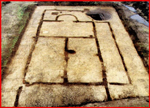
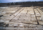
In this context a relatively well preserved ground plan of a narrow, 20 to
45 meters long sill beam building directed NE-SW which was uncovered in the
eastern
part of the Neurissen location is undoubtedly of a great importance. It comprises
at least five rectangular rooms, one of them with an apsidal enclosure.
The foundations of the walls belonging to the western part of the structure
were 50 cm wide and approximately 120 to130 cm deep, indicating that the architecture
of the building must have been quite outstanding. Accordingly the courtyard
and
the peristyle of the structure may have served as a living quarter which could
be compared with „triclinium” or „reception-room” in the Roman civil architecture.
A lot of objects and artifacts found in this area and dated to the second half
of 2nd century make it probable that this building was constructed at the time
of the Marcomannic wars as well.
Despite of the civilian architectural elements in the built-up area of „Burgstall”
and „Neurissen”, the majority of artifacts and objects, particularly from the
hillfort, nevertheless are of military nature. The hitherto investigations
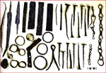
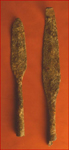
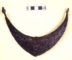
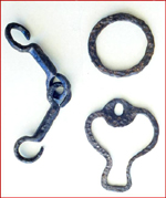
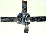
have yielded an impressive collection of small finds, mainly Roman weapons
and typical
military equipment. Thousands of hobnails from soldiers' footwear were found
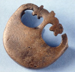
most frequently. The wide variety of belt fittings in open work, bronzestuds
and buckles is comparable with the findings elsewhere in the limes-region.
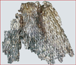
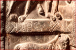
Exceptional finds among the numerous remnants of scale armour are the bronze,
iron and rarely
silver cuirass breastplates, one of them with the inscription of the 10th Legion.
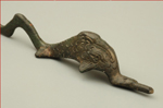
There are lances, spearheads, significant number of parts of horse bits and
harnesses, bronze and iron peltate scabbard chapes and also a scabbard - slide
elaborated
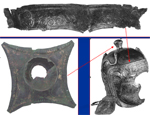
in the shape of dolphin. Helmets were represented in archaeological record
by a number of fragments including some relics of the Niederbieber
and Heddernheim types.
 |
 |
 |
 |
||
 |
 |
 |
 |
 |
 |
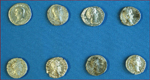
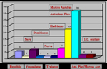
It has to be stressed out that among the pottery the Roman production reaches
an overwhelming proportion. Some archaeological materials, especially Samian
ware of the
prevailing late Lezoux production, together with several pieces of early Rheinzabern
ware and numerous coins evidence that this fort was used especially at the
time of the Marcomannic Wars. The fragments of Germanic pottery are
only known
in a few pieces, the majority of them come from later pits and features secondarily
dug up in the Roman stratum.
Although the adjustment of the defences and an astonishing number of artifacts
prove the military employment of the location, the masonry buildings excavated
by A. Gnirs on the top and other structures including the one of Neurissen
are of a civilian nature and indicate that civilian components were represented
here
in a distinctive manner. On the other hand there is some uncertainty as
to how the army troops were housed at the site. The explanation of this might
be that so far only the most conspicuous structures have been uncovered. The
rather large, hitherto unexcavated areas of the base could reveal the relics
of military barracks. The shape of the defence which respects the natural form
of the hill represents a non-standard, but not entirely exceptional form of
a Roman outpost, erected outside the territory of the Empire for strategic
purposes
of the army.
Continued aerial research of the Mušov area during the recent years has yielded
further structures in the vicinity which are of military character. First of
all we have to mention the outline of a long ditch in less than 1 km distance
to the north-west from the earth ramparts of the Burgstall hillfort. It stretched
in the southwest-northwest direction over more than 2 km.
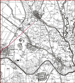
Although its
full routing has not been corroborated, we may assume that the ditch ended
somewhere
near a marching or temporary camp in Ivaň, and that its original length was
slightly over 4 km. The V-shaped ditch was 4.4 m wide and 1.98 m deep, and
a gate with
a „titulum” was a proof of its Roman origin. All evidence suggests that the
ditch was enclosing the entire area - measuring almost 9 square kilometres
- outlined
by the confluences of the Dyje and Svratka, and the Jihlavka and Svratka Rivers.
Access routes to this area were guarded by a temporary camp concentration in
the location „V pískách” on the southern side, and by the temporary
camps at Ivaň on the northern side. Crop-marks repeatedly picked up by aerial
photography of the north-west foreground of the area surrounded by the ditch
indicate that another one of the temporary camps securing an access from the
west was probably located here. As shown by the discovery of the marching camps
in Přibice and further north in Modřice near Brno, all these military installations
were located on the main route running from the Roman enclave in Mušov to the
north.
It is not without significance that the area, marked off on two sides by the
arms of the Dyje, Jihlavka and further also the Svratka Rivers and separated
from other land by a fortification mentioned above, contains not only the Roman
structures at „Burgstall” and „Neurissen”, but also a richly outfitted king's
grave the territorial connection of which with the Roman features is all the
more conspicuous since its equipment has been strongly influenced by the Roman
funeral customs. The discovery of a long fortification carving out such a large
tract of land, which may be viewed as a demonstration of direct Roman influence,
is hitherto without precedence in the region beyond the Roman Frontier.
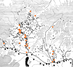
The high concentration of marching or temporary camps and other Roman arrangements
in the neighbourhood of the fortified sites at Burgstall is an evidence of
one of the biggest concentrations of military installation in the region and
an immense
gathering ground for Roman troops, the springboard for further invasions and
advances to the north.
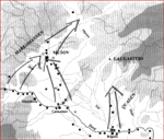
Such an interpretation of the fort placed with
strategic as well as tactical considerations in mind seems to be supported
by the discovery of workshops, baths, ovens for bread baking etc., evidently
serving
the Roman troops which operated here. More luxurious buildings were probably
intended for the stay of senior officers or high representatives of the Roman
administration. There are many other questions to be asked about the function
of the site and the manner of utilization of the space within. The association
of military and civilian elements at the site is an important piece of evidence
stressing its function not only as the largest military centre of the region
but also as a supply base, a military settlement accommodating various services
and industries, contrary to what is usually noted in the provinces situated
within the fortified area. Rome reacted in this way to the local situation
within the
territory of the enemy and developed an individual solution to the problem
of securing the necessary supply.
Speculations about the function of the newly discovered Roman structures prompt
the question whether, considering their character and uncommon expanse, they
could form the nucleus of a future military and administration centre of the
captured territory. The issue is then directly tied to the historical question
concerning the Romans' intention to establish a „province of Marcomannia” which
is continually discussed in both historical and archaeological literature.
AUCR